|
|
|
GIS / CAD Services
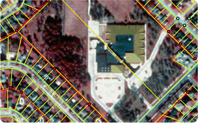
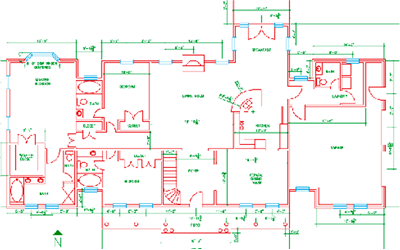
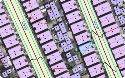
Our Geospatial Group consists of a unique blend of highly specialized GIS professionals that have significant experience in the deployment of GIS technology and come from diverse areas within the GIS industry and community. We offer full line of GIS services including aerial and satellite image mapping, and Geodatabase modeling and design. With a decade of project experience, we have developed an impressive reputation for high quality solutions, delivered on time and within budget. Our services include » Creation / Maintenance of Geospatial Database» Data Integration and Data Format Conversion » Spatial Analysis and Modeling » Image Georectification / Georeferencing/Spatial Adjustment » Map Digitization / Vectorization / Feature Extraction » Agriculture/ Forestry, Status change detection » Utility Mapping » Feature Extraction » Route Network Analysis » 3D shapefile creation » TIN Creation » Attribution » Parcel mapping and updation » Topology Validation » Thematic mapping |
|
|||||||||||||||

|
|||||||||||||||||
| © Copyright 2013, Vision Geo Informatics |
Follow Us :


|