|
|
|
LIDAR Processing
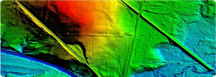
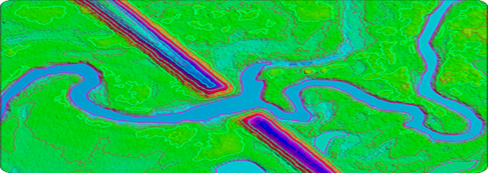
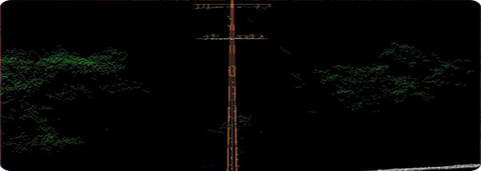
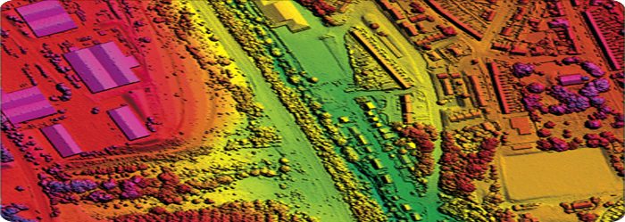
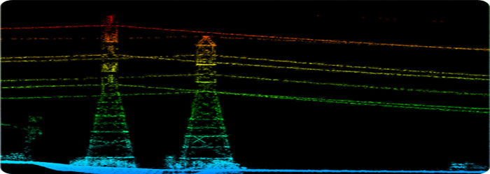
Services for Global Crop Condition Assessment Vision Geo Informatics has a full capacity LiDAR Processing Team . The Team members have different levels of competence and experience hence functional Sub-Teams with domain specific expertise and experience are encouraged. We have performed several thousand sqkms of LiDAR data processing projects in different geographies of the world, primarily, Australia, North America Bare Earth ClassificationsVision Geo Informatics has performing classification of Bare Earth and Above Ground Features such as low vegetation, high vegetation, buildings and bridges. We have performed several power line classification projects requiring the capture of features such as the power lines themselves for sag analysis and the associated features like, pylons, poles, substations etc. BareEarthClassificationwithBreaklinesandHydroLinesThe LiDAR data can be enhanced for the generation of accurate contours by using Breaklines and Hydro Lines. These can be digitized within the dataset using tools available in Terrascan / Terramodeler. Breaklines are necessary to create dataset which are hydrological correct or to fill any other gross errors in the LiDAR data. Mobile LiDARThe use of Mobile LiDAR systems enters the scene when large areas have to be surveyed at accuracy and resolution exceeding those available through aerial photogrammetry, and when using static LiDAR is impractical. The Lynx Mobile Mapper captures high-accuracy, high-density points, allowing easy and precise identification of objects. Vision Geo Informatics has experienced Operators to perform Mobile LiDAR Classifications. We have finished around 500 miles of road corridor project. |
|
|||||||||||||||

|
|||||||||||||||||
| © Copyright 2013, Vision Geo Informatics |
Follow Us :


|