|
|
Planimmetric Feature Collection
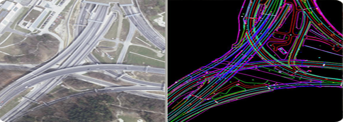
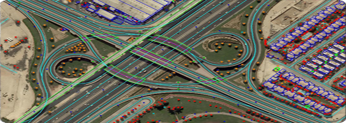
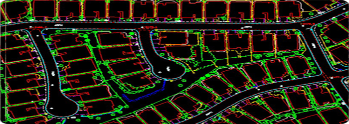
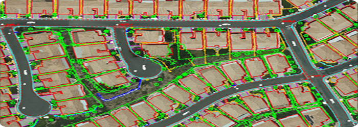
Planimmetric mapping shows only horizontal features on a plane surface, without
elevation contours to depict the terrain. Topographic features not captured such
as roads, buildings, and bodies of water that are visible and identifiable on aerial
photographs can be compiled into map features through photogrammetric surveying
procedures.
Vision Geo Informatics uses the latest in technology to produce the most accurate
Planimmetric mapping services. Our experienced mapping technicians execute accurate
stereo data compilation of Planimmetric features to the satisfaction of our customers.
Since our deliverables serve as the base maps for various applications, utmost care
is taken at our end ensuring all our deliveries are in full compliance with project
specifications.
Our services include » national
mapping
» topographic surveys
» civil survey planning & design
» plant/facility planning & management
» roadway design
» storm water management
» utility management
» as-built surveys
» mine mapping and management
|
|
|
|
Contact Info
|

|
040 - 65177667
|

|
+91 - 8008377667
|

|
+91 - 9703146644
|

|
info@
visiongeoinformatics.com
|
|
|